
Online Maps for the UK
Reviews and ratings of quality, hand-picked, websites
![]() QUICK PICKS
QUICK PICKS
Google Maps
• http://maps.google.com - without doubt the best online map at the moment.
Streetmap.co.uk
• www.streetmap.co.uk
Multimap
• www.multimap.com
Google Maps
• http://maps.google.com
Unlike Google Earth (see below), you can access Google maps directly online with no downloads. Like Microsoft's Local Live you can choose between map view, satellite view or hybrid view. You can also get directions from one place to another anywhere in the world. Currently, all the locations we have viewed are at a higher magnification on Google Maps than on Local Live - this may change but as of now Google is the clear winner.
Windows Local Live
• http://local.live.com
 With Windows Local Live you can use ordinary map view or ariel map view, get route directions and more. It is an online map so there is nothing to download (unlike Google Earth) unless you want to use the 3D view in which case you will be prompted to install Virtual Earth 3D (Windows XP SP2 or later).
Google Earth
• http://earth.google.com
Bliss!! For areas that are mapped by Google Earth the detail is fantastic. Download this and you will probably spend the next couple of hours just browing around. You can type in an address and it will zoom in there for you. You can also search for schools, parks, restaurants and hotels plus get driving directions.
Its a large program and you will need broadband to use it.
Platforms: Mac OS X, Windows, Linux
AlpineSkiMaps
• www.alpineskimaps.com
Headers: Ski Maps
Very detailed trail maps for ski destinations in Austria, Germany, Italy, Switzerland and France.
English Nature
• www.english-nature.gov.uk
Headers: Wildlife, Publications & Maps, Special sites, Nature on the Map, Lathkill Dale NNR virtual tour, SSSI information, Volunteer information, Geological sites, Nature for Schools
English Nature is a government agency with the aim of conserving wildlife, geology and wild places in England. There is detailed information on all areas of England. Click on special sites for access details of national and local nature reserves, geological sites plus details of guided walks and events.
Google Earth
• http://earth.google.com
Bliss!! For areas that are mapped by Google Earth the detail is fantastic. Download this and you will probably spend the next couple of hours just browing around. You can type in an address and it will zoom in there for you. You can also search for schools, parks, restaurants and hotels plus get driving directions.
Its a large program and you will need broadband to use it.
Platforms: Mac OS X, Windows, Linux
Map 24 UK
• www.uk.map24.com
Headers: Search, Calculate Route, Personal Settings
Very simple and easy to use site. Just select country and then type in the address or postcode and the map displays. You can then zoom in or out. The calculate route feature works well, giving detailed instructions and mileage which you can print out. You can also click on any point along the route instructions and it will show on the map. Excellent website.
Mapquest
• www.mapquest.co.uk
Headers: Find a map
Enter loacation details and you get a map that you can print, download to a handheld or email. Useful! You can even customize the map and get directions to the location by using their route finder facility which also has display options. Again you can either print, download to a handheld or email the results. Maps cover Europe and the UK. Excellent site.
Mapzone
• www.mapzone.co.uk
Headers: Homework Help, Our Favourite Places, GIS Zone, Did You Know?, Games, Competitions, Map School
Mapzone (which is in association with Ordnance Survey) is an excellent resource for children who are learning about maps. There is lots of information, games and downloads and the site layout is fun and very easy to use. An excellent homework resource is the downloadable Map Builder program (about 3.5Mb) where you can play about building up your own customisable map of either Britain, Europe or the World.
Multimap
• www.multimap.com
Headers: Maps, Directions, Aerial Photos, Traffic Information, London Tubemap, Wireless, Business Services
Free online maps of the UK and Europe, with scales from 50,000:1 to 40,000,000:1 which can now be accessed from WAP phones, wireless enabled Palms and Psions. You search by clicking on the map.
National Geographic Maps
• www.nationalgeographic.com
Headers: Map Machine
Very useful for conservation and ecology maps, satellite maps, earthquake maps, and climate maps.
National Statisitics Online - UK Map Collection
• www.statistics.gov.uk/geography/maps.asp
Headers: Administrative Geography Maps, Health Geography Maps, Electoral Geography Maps, NUTS/LAUs Area Maps, Maps of Other Geographies
Useful collection of about 30 maps which you can also download as pdf documents. In addition there is also a beginners guide to geography which is "a simple, informative and colourful tour of the main territorial units used in National Statistics work." So, there you are.
Ordnance Survey
• www.ordnancesurvey.co.uk
Headers: Business, Map Shop, Free & Fun, Education
Aside from buying your OS maps here, you can also download free outline GB maps in various formats, including editable, of the GB Coastline and admin boundaries plus you can view zoomable OS maps online using their "get-a-map" facility. Its actually painfully slow compared to other map sites (hence 3 stars only), but then they are OS maps, so maybe they are worth the wait! I also like this site because there is plenty of information about mapping, GPS systems and Geofacts about Britain plus online games and wallpaper.
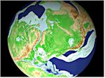 Paleomap Project
• www.scotese.com
Full colour paleogeographic maps plus interactive 3D virtual globes and 3D paleogeographic animations. Plus lots of articles and information about the Earth's past. The website is operated and maintained by Christopher Scotese who is currently doing research at the University of Texas.
Ski maps.com
• www.skimaps.com
Headers: Ski Maps, News, Forums
Ski Trail Maps for United States, Canada, Europe, South America, Asia-Middle East-Africa and the Pacific Rim. Also, ski news and reasonably active forums.
Streetmap.co.uk
• www.streetmap.co.uk
Headers: Great Britain Street & Road Map
Search by street, post code, place name, lat/longitude, OS grid reference or telephone code. Very fast. Large scale maps.
Transport for London/Maps
• www.transportforlondon.gov.uk
Headers: Tube, DLR, Buses, River, Streets, Taxi/Private Hire, Coach Station, Trams, rail, Dial-a-Ride
As well as printable tube, bus and river maps, the site also has an interactive tube map - just click on any station and you get details of bus connections, train times, station facilities, station access, travel information centres and for some stations you can get an online area map (printable pdf documents). However, there is much more to this site than just maps, it is packed with information to do with getting around London from cycling to traffic management to the latest news about London Transport.
Macro History
• www.fsmitha.com
Headers: World History
Written by Frank Smitha, the website consists of a huge number of scholarly articles (with accompanying images) covering a large swathe of history from prehistory to the present time. In addition there are maps, country profiles, definitions and comments. A great achievement and very readable.
Historical maps from the ancient world to the present.
Can't find it?
Try our search engines, price comparison and online auction pages.